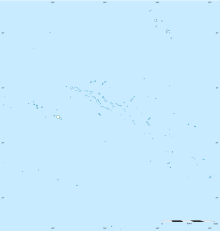
Ua Pou Airport
Ua Pou Airport | |||||||||||
|---|---|---|---|---|---|---|---|---|---|---|---|
| Summary | |||||||||||
| Airport type | Public | ||||||||||
| Serves | Hakahau, Ua Pou | ||||||||||
| Location | Marquesas Islands, French Polynesia | ||||||||||
| Elevation AMSL | 16 ft / 5 m | ||||||||||
| Coordinates | 09°21′06″S 140°04′40″W / 9.35167°S 140.07778°W | ||||||||||
| Map | |||||||||||
| Runways | |||||||||||
| |||||||||||
Sources: Great Circle Mapper [1] | |||||||||||
Ua Pou Airport is an airport on Ua Pou in French Polynesia (IATA: UAP, ICAO: NTMP). The airport is 11 km northwest of the village of Hakahau. As of 2021 it received 3900 passengers a year.[2]
The runway is short, narrow, and slopes uphill, making Ua Pou an Altiport.[3] Aircraft can only land when arriving from the sea, and can only take off towards the sea, whatever the prevailing wind.[3] The runway is 846m long, with a 30m drop.[4]
Airlines and destinations
| Airlines | Destinations |
|---|---|
| Air Tahiti | Atuona, Nuku Hiva, Ua Huka |
Statistics
Graphs are unavailable due to technical issues. There is more info on Phabricator and on MediaWiki.org. |
Annual passenger traffic at UAP airport.
See Wikidata query.
References
- ^ Great Circle Mapper - Ua Pou Airport
- ^ "Statistiques annuelles: Aéroport de Ua Pou". UAF&FA. Retrieved 24 November 2022.
- ^ a b "Evasan depuis Ua Pou : l'équipage du Casa de l'armée a fait des prouesses" (in French). Tahiti Infos. 10 December 2014. Retrieved 24 November 2022.
- ^ "Ua Pou – Le départ" (in French). A la rencontre du Soleil. 8 September 2017. Retrieved 24 November 2022.
External links
- NTMP – UA POU. AIP from French Service d'information aéronautique, effective 16 May 2024.

